
Where Is the Sinai Peninsula and Why Is It So Important?
If you've ever wondered "where is the Sinai Peninsula," you're not alone. This triangular landmass holds a unique position on the world map, bridging continents and cultures. The Sinai Peninsula is one of Earth's most geographically and historically significant regions, serving as a natural land bridge between Africa and Asia.
Where Is the Sinai Peninsula Located?
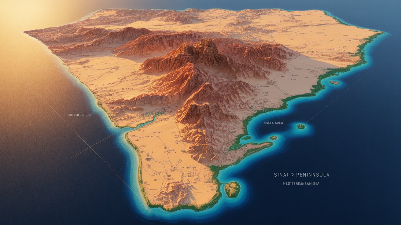
The Sinai Peninsula is located in northeastern Egypt, forming a distinctive triangular wedge of land that connects the African continent to Asia. This strategic peninsula is bordered by the Mediterranean Sea to the north and the Red Sea to the south, with two important gulfs flanking its sides: the Gulf of Suez to the west and the Gulf of Aqaba to the east.
Geographic Coordinates and Boundaries
The Sinai Peninsula spans approximately 61,000 square kilometers (23,500 square miles). Its borders are clearly defined by water on three sides, while its western boundary with mainland Egypt is marked by the Suez Canal, one of the world's most important maritime passages.
To the east, the Sinai Peninsula shares a land border with Israel and the Gaza Strip, making it a region of significant geopolitical importance. The peninsula's northernmost point touches the Mediterranean coast, while its southern tip extends into the Red Sea at Ras Muhammad, a famous diving destination.
The Sinai Peninsula's Continental Position
One of the most fascinating aspects of the Sinai Peninsula is its transcontinental nature. Although politically part of Egypt (an African country), the Sinai Peninsula is geographically considered part of Asia. This makes it the only land connection between the two continents, a feature that has shaped human history for millennia.
The peninsula sits at the junction of the African and Arabian tectonic plates, which explains its dramatic mountainous terrain and geological features. This tectonic activity created the Red Sea rift system and continues to shape the region's landscape.
Key Geographic Features of the Sinai Peninsula
Mountain Ranges
The southern portion of the Sinai Peninsula is dominated by a rugged mountain range. Mount Sinai (also known as Jebel Musa), rising to 2,285 meters (7,497 feet), is the most famous peak and holds deep religious significance for Judaism, Christianity, and Islam. The highest point in the peninsula is Mount Catherine at 2,629 meters (8,625 feet).
Deserts and Plains
The northern Sinai Peninsula consists primarily of desert plains and sand dunes, creating a stark contrast with the mountainous south. This arid landscape has been home to Bedouin communities for centuries and presents both challenges and beauty to those who traverse it.
Coastal Areas
The peninsula's extensive coastline along the Red Sea has become renowned for its crystal-clear waters, vibrant coral reefs, and marine biodiversity. Popular resort towns like Sharm el-Sheikh and Dahab dot the southeastern coast, attracting millions of visitors annually.
Why the Sinai Peninsula's Location Matters
The strategic location of the Sinai Peninsula has made it historically significant as a trade route, military corridor, and cultural crossroads. Ancient civilizations, including the Egyptians, Romans, and Ottomans, recognized its importance and sought to control it.
Today, the Sinai Peninsula remains crucial for international shipping through the Suez Canal and serves as a vital tourism hub. Its location also makes it an important region for energy resources, including natural gas fields discovered in recent decades.
Cities and Settlements in the Sinai Peninsula
Several cities and towns are located within the Sinai Peninsula, each with its own character:
- Sharm el-Sheikh: A major resort city on the southern tip
- Dahab: A laid-back coastal town popular with backpackers and divers
- Nuweiba: A port city on the eastern coast
- Taba: A border town near Israel
- El-Arish: The largest city, located on the northern Mediterranean coast
- Saint Catherine: A small town near the famous monastery and Mount Sinai
Climate and Environment
The Sinai Peninsula experiences a desert climate, with hot, dry summers and mild winters. Rainfall is scarce, particularly in the interior, though the coastal areas receive slightly more precipitation. The southern mountains can experience cooler temperatures and occasional winter snow at higher elevations.
This arid environment supports unique desert ecosystems, including species adapted to extreme conditions. The surrounding seas, however, teem with life, making the coastal waters some of the richest marine habitats in the world.
How to Visit the Sinai Peninsula
Travelers wondering where is the Sinai Peninsula and how to get there will find it easily accessible. The region has two international airports: Sharm el-Sheikh International Airport and Taba International Airport. Overland access from mainland Egypt is possible through the Ahmed Hamdi Tunnel and the Suez Canal Bridge.
Many visitors enter the southern Sinai Peninsula visa-free for tourism purposes, making it an attractive destination for Red Sea beach holidays, desert adventures, and spiritual pilgrimages.
Conclusion: The Sinai Peninsula's Unique Position
The Sinai Peninsula occupies a truly exceptional position on our planet. Located in northeastern Egypt, it serves as the only land bridge between Africa and Asia, bordered by the Mediterranean Sea, the Red Sea, the Gulf of Suez, and the Gulf of Aqaba. Its strategic location, combined with its stunning natural beauty and rich history, makes it a region of enduring global significance.
Whether you're drawn to its crystal waters, ancient mountains, or historical importance, understanding where the Sinai Peninsula is located helps you appreciate why this triangular slice of land has captivated humanity for thousands of years.
